
There is a missed opportunity for many media outlets when an African country is in the news. That opportunity has to do with size.
To understand the challenge of air lifting people spread out in a country that is as big as Sudan, size references help.
Here is an image showing how Sudan overlaps the Scandinavian Peninsula and Finland. Its western border aligns with Norway’s westernmost border (and a bit into the Norwegian Sea), and its eastern border aligns with Finland’s eastern border, and then also stretches further into Russia in the northeast. The height of Sudan aligns with Sweden’s height.
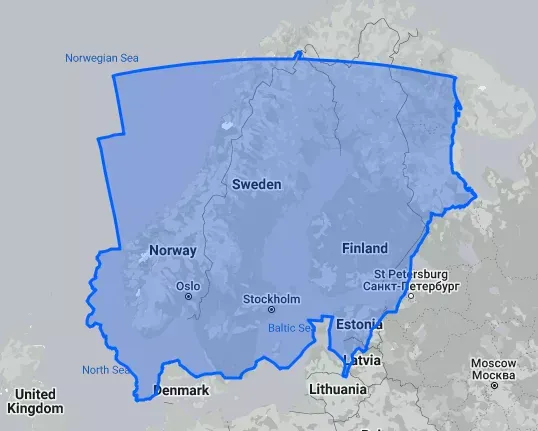
From a land mass perspective you could easily throw in Denmark, Iceland and the UK inside the perimeter as well (to cover parts of the Baltic, North, and Norwegian Sea).
For perhaps obvious reasons most densely populated areas are along the Nile river, but size matters in providing the complete picture of the conflict. Many world maps in the news to a really poor job of communicating size, and I see this as a failure in reporting. Instead they often reinforce biases about country size.
Read more about maps